Heritage
A history of the Embankment
The Embankment is not an empty field waiting for a use. It is the surviving open piece of a riverside landscape that has been monastic meadow, inland port, civic pleasure ground and festival field. For over a thousand years, this is where Peterborough has met its river.
Before everything else
The river made it, and the river still shapes it
Peterborough sits at a threshold. West of the city the Nene runs through a defined valley; immediately east it enters the flat, historically wet Fens. The Embankment occupies low, alluvial ground on that edge. Before modern drainage and engineered banks this was a shifting landscape of channels, seasonal flooding, wet meadow and marshy margins.
That explains the Embankment's whole story. The river connected Peterborough to the Midlands, the Fenland waterways and the sea, but the land beside it was too wet to build on. Its survival as open space is not an accident of neglect. For most of its history it was simply better suited to meadow, grazing, water management and recreation than to construction. The Environment Agency's flood maps say the same thing today in modern language.
7th century onwards
The abbey's riverside
Central Peterborough grew around the monastery of Medeshamstede, traditionally founded in the seventh century and later refounded as one of England's richest Benedictine abbeys. The Nene was fundamental to monastic life: transport for heavy goods, fisheries, water, drainage and communication with estates downstream. The ground between the Cathedral and the river was a productive monastic landscape of orchards, closes and meadow, a working edge between precinct, town and navigation.
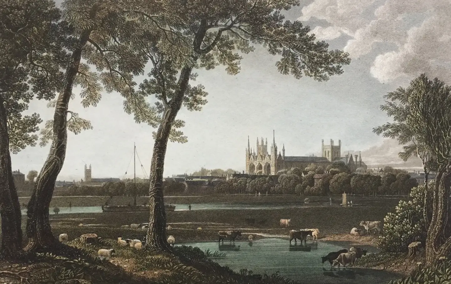
The land stayed connected to church ownership for centuries. In 1709 the bell-founder Henry Penn, working near what became Bishop's Road, cast a peal of ten bells for the Cathedral, a reminder that this riverside could be semi-industrial as well as green. The view of the Cathedral across open ground, the one thing every generation of this landscape has shared, dates from this deep layer of the city's history.
1761 to 1937
Port, bridges and the engineered river
Navigation improvements made the Nene passable to Northampton by 1761, and in 1815 the Northampton Arm joined it to the national canal network. Grain, coal, timber and stone moved through a modest inland port at the Town Bridge, where the Customs House still stands, home to the Sea Cadets since 1942. Photographs from around 1919 show cattle drinking at the water's edge beside it: working river and grazing meadow side by side.
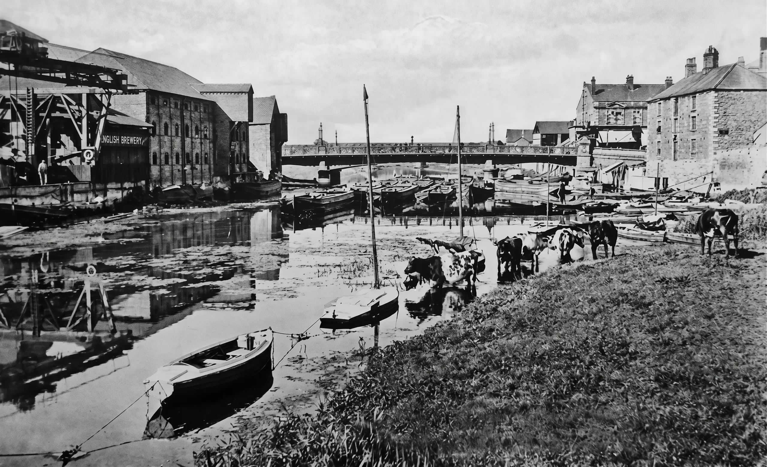
The Great Northern Railway arrived in 1850 on a cast-iron viaduct by William and Joseph Cubitt, built by Thomas Brassey, now Grade II* listed and among the oldest cast-iron railway bridges in Britain still carrying main-line trains. The iron Town Bridge of 1872 was replaced by the present concrete bridge in 1934 as part of the same 1930s Embankment Scheme that laid out Embankment Road, the gardens and the new pool. Downstream, the Dog-in-a-Doublet lock of 1937 shut the tide out of the city and fixed the calm river levels we know today. The Embankment's settled appearance is itself a work of engineering.
1927 to 1992
The Lido: the city learns to play by the river
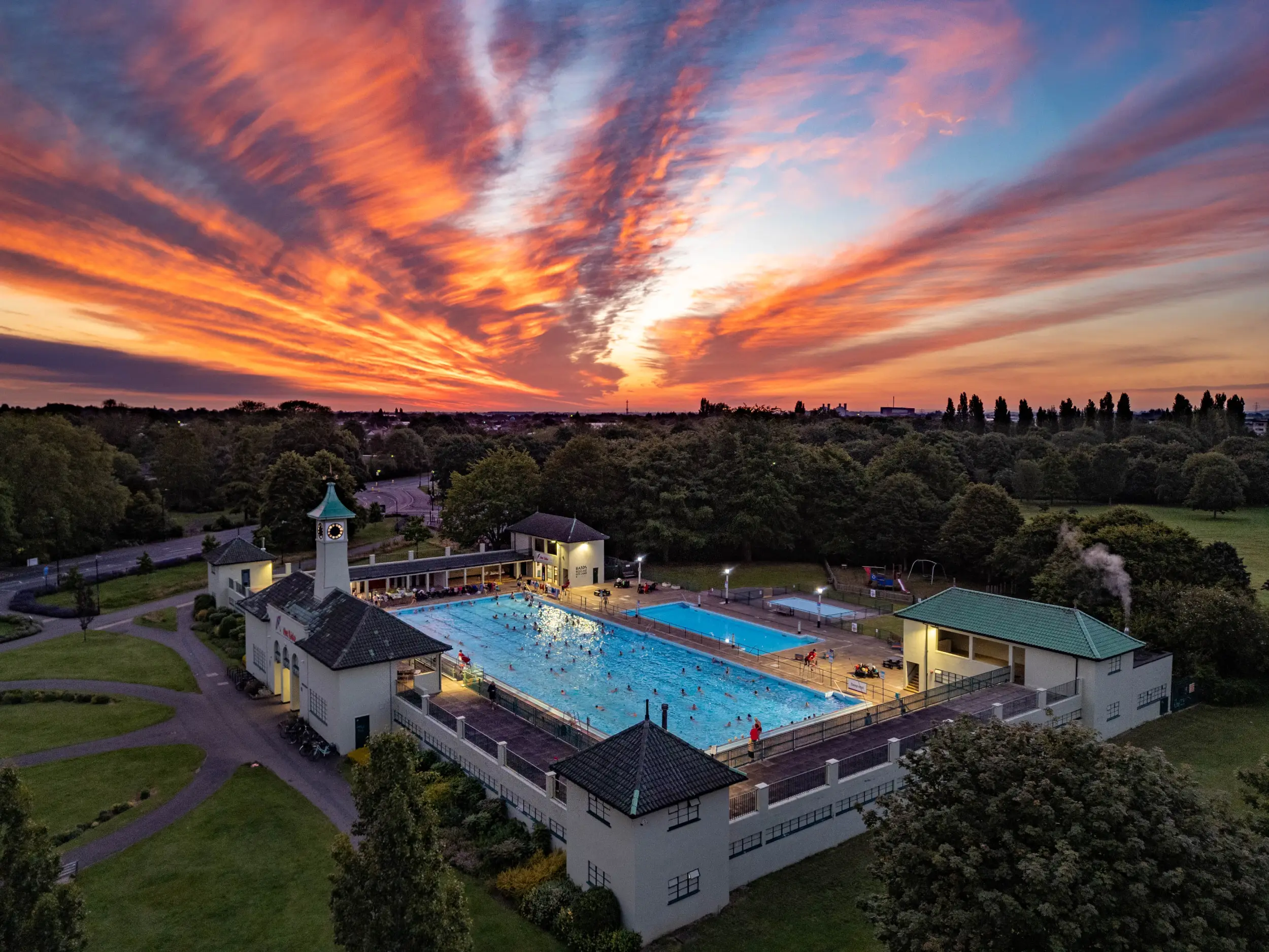
People swam in the open Nene long before there was a pool, with all the risks that carried. In 1927 the Corporation bought the riverside land from the Ecclesiastical Commissioners, and in 1933 five local architectural practices designed a municipal pool together without a fee, its construction providing work for unemployed local men. The Corporation Swimming Pool, today's Lido, opened on 28 May 1936: a 55-yard pool, diving boards, water chute, café, terraces and Art Deco, Mediterranean-flavoured pavilions.
A German bomb damaged the north-west pavilion in June 1940 and the pool was swimming again within weeks. The decades after the war filled it with school lessons, galas, channel swimmers in training and characters like Walter Cornelius, the Latvian-born lifeguard, strongman and fundraiser fondly remembered for trying to fly across the Nene on homemade wings. Threatened with demolition in 1989, the Lido was saved by public campaign, refurbished and Grade II listed in 1992. It remains the clearest proof of what this riverside means to people: when the city tried to take it away, the city refused.
The details of the Lido's story here follow the Friends of Peterborough Lido's published history, the fullest local account.
1973 onwards
Theatre, pool and the festival field
The Key Theatre opened beside the river in 1973 and was refurbished with a new studio in 2010. The indoor Regional Pool followed in 1976, serving the fast-growing city until structural problems forced its closure and demolition, with a replacement leisure centre now proposed within the wider Embankment area.
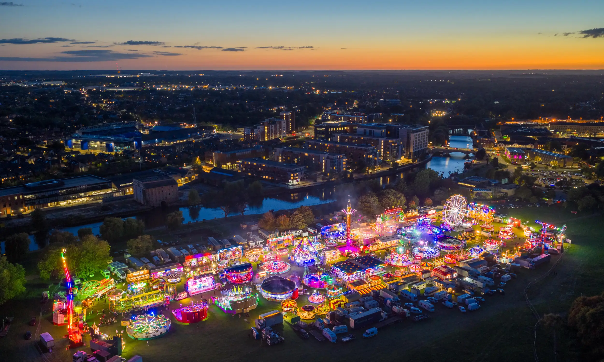
Meanwhile the open lawn became something no building could be: the city's gathering ground. The CAMRA Peterborough Beer Festival, held here since the late 1970s, grew into one of Britain's largest outdoor beer festivals, a temporary city of marquees beside the river. The Peterborough Festival's parades and concerts, funfairs, fireworks and community celebrations have all relied on the same rare combination: level open ground, riverside setting, Cathedral views, and room. This is a distinctive kind of heritage. Unlike a formal Victorian park, the Embankment's value lies in its openness and adaptability, and that value vanishes the moment the openness does.
2005
Pickle's Copse and the Trafalgar trees
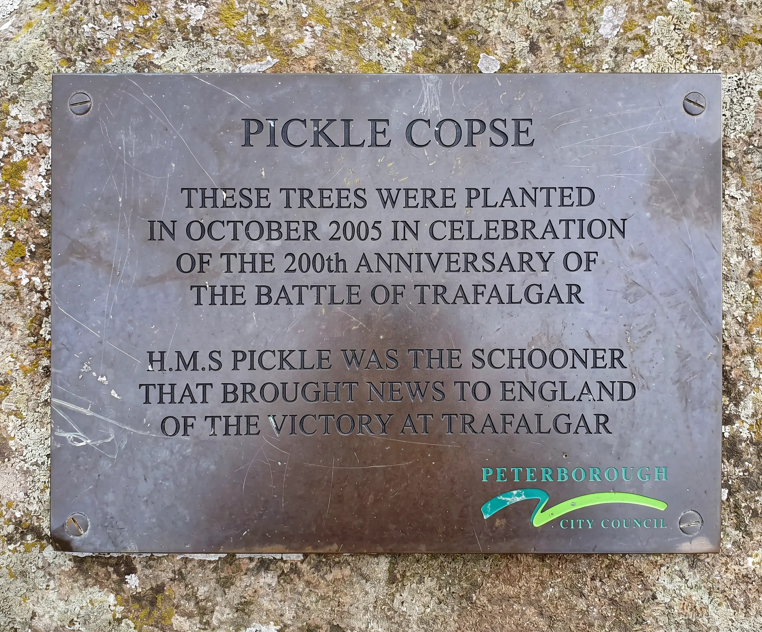
In 2005, the bicentenary of the Battle of Trafalgar, the Woodland Trust and the Society for Nautical Research ran the national Trafalgar Woods project: a new wood planted for each ship of Nelson's fleet, celebrating the roughly fifty thousand oaks it took to build it. Among the ships so honoured was HMS Pickle, the little topsail schooner that was too small to fight at Trafalgar but carried the news of the victory, and of Nelson's death, home to Britain in November 1805.
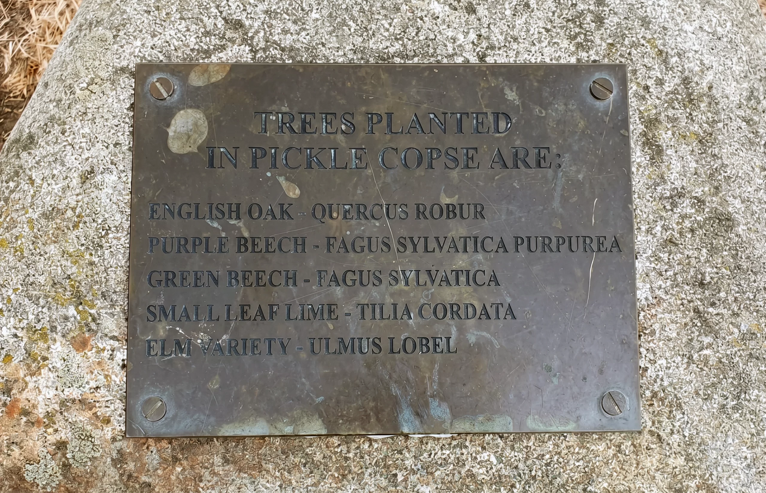
Local accounts describe a commemorative planting and plaque for HMS Pickle among the trees of the Embankment, a small copse holding a very large story. It is a fitting one for this riverside: the navy that Pickle sailed with was built from trees, and the schooner's name is still toasted every fifth of November at the Royal Navy's Pickle Night. If you know the copse, treat it kindly. It is part of the quiet accumulated meaning that makes this ground more than a development site.
2022 onwards
The contested present
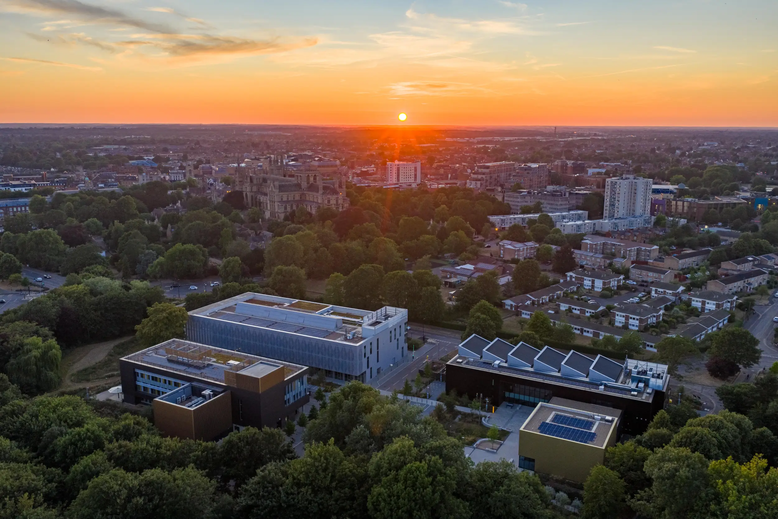
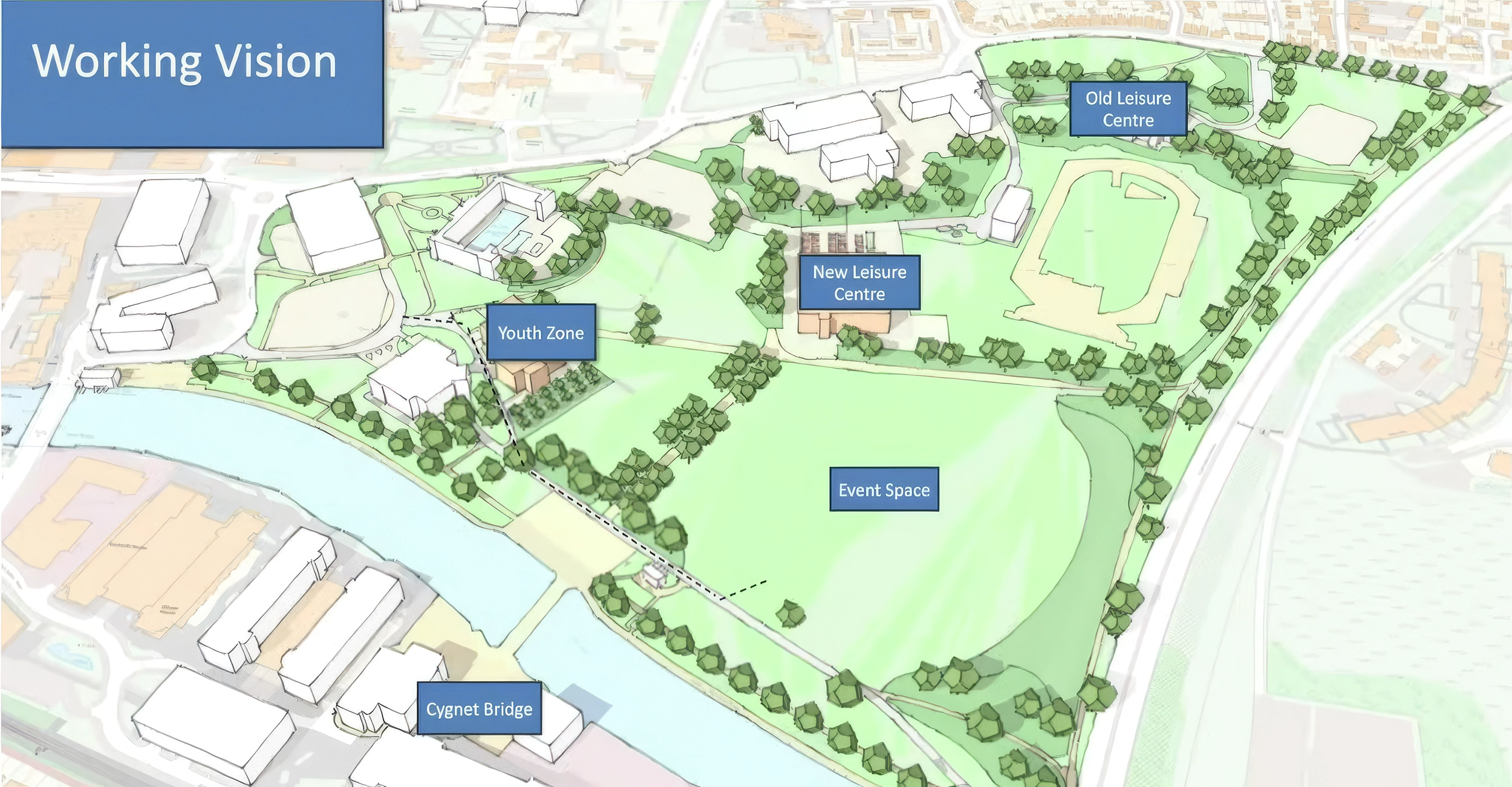
The latest layer is being added now. ARU Peterborough opened its first phase in 2022, largely on former parking and previously developed land at the Embankment's edge. Cygnet Bridge, granted permission in December 2024 and under construction since 2026, will link the Embankment to the regenerated Fletton Quays and make the river a two-sided urban space for the first time. The council's wider programme talks of education, leisure, culture and housing around the green.
A thousand years of history offer a simple test for all of it. The Embankment has never been untouched; it has repeatedly adapted. But every layer that lasted, from monastic meadow to Lido to festival field, kept the essential things intact: the openness, the green, the river and the view of the Cathedral. Development that serves those things joins the story. Development that erases them ends it.
Then and now
Slide between the 1890s and today
Drag the slider to fade between Victorian Ordnance Survey mapping and the modern map. Watch how much has changed around the Embankment, and how the green itself has not.
Historic mapping: Ordnance Survey one-inch, 1885 to 1900, reproduced courtesy of the National Library of Scotland. Modern mapping © OpenStreetMap contributors.
Chronology
Medeshamstede monastery develops beside the Nene; the riverside becomes part of the monastic estate.
Morton's Leam improves drainage and navigation east of the city.
Henry Penn casts a peal of ten bells for the Cathedral near the later Bishop's Road.
The Nene becomes navigable to Northampton; the Northampton Arm joins it to the canal network in 1815.
The Great Northern Railway opens, crossing the Nene on the Cubitts' cast-iron viaduct, now Grade II* listed.
An iron Town Bridge replaces the earlier timber crossing.
The Corporation buys the future Lido site from the Ecclesiastical Commissioners.
The present Town Bridge opens as part of the 1930s Embankment Scheme of road, gardens and pool.
The Corporation Swimming Pool, today's Lido, opens on 28 May.
Dog-in-a-Doublet lock excludes the tide and stabilises river levels through the city.
A German bomb damages the Lido's north-west pavilion; the pool reopens within weeks.
The Key Theatre opens beside the river.
The indoor Regional Pool opens.
The CAMRA Peterborough Beer Festival begins its long residence on the Embankment lawn.
The Lido is threatened with demolition, saved by public campaign, refurbished and Grade II listed.
The national Trafalgar Woods project marks the battle's bicentenary; local accounts record a planting for HMS Pickle on the Embankment.
ARU Peterborough opens its first phase on the Embankment's western edge.
Cygnet Bridge is approved and construction begins; the Regional Pool site is cleared; the Embankment's future is contested once again.
Sources and further reading
- Friends of Peterborough Lido: Our Lido History The fullest account of the Lido's purchase, design, construction, wartime damage and rescue.
- Peterborough Civic Society: Blue Plaques The Customs House, the 1930s Embankment Scheme and the city's riverside heritage.
- Nene Rivers Trust: History of the River Nene Navigation, drainage works and the Dog-in-a-Doublet lock.
- Key Theatre The theatre's opening in 1973 and 2010 refurbishment.
- CAMRA Peterborough Beer Festival The festival's home on the Embankment.
- Peterborough Images: Town Bridge and the Nene, c.1919 Cattle at the water's edge beside the working river.
- Woodland Trust: Trafalgar Woods project, 2005 The national bicentenary planting of a wood for each ship of Nelson's fleet, including HMS Pickle.